Monthly Archives: February 2012

Sonar heard in Puget Sound – through WA State ferry!

Washington State ferry workers and passengers on the Clinton-Mukilteo route heard sonar sounds above water (presumably coming through the hull) that lasted for about an hour this afternoon (Wednesday 2/29/2012).  Jenny Atkinson, Executive Director of The Whale Museum said that the Washington State Ferries operations center had called the Musuem’s stranding/sighting hotline to report that the ferry workers on the Clinton-Mukilteo run were complaining about sonar noises this afternoon.  Dr. Jason Wood, a bioacoustician and Research Associate with the Museum, requested further details from the operations center and obtained this chronology:

  • 15:49 Approximate local Pacific time that sonar pings begin
  • 15:54 First call from ferry workers to operations center stating that sonar pings had started 5 minutes before.
  • 16:30 A second call is received saying pings are still loud in the ferry’s engine room
  • Total duration of sonar pinging was ~ 1 hour

He also learned that:

“The crew in the engine room, the captain, and passengers could hear the sonar, at times so loudly that the ferry agent on land could hear the sonar coming up through the ferry while it was at the dock…. The operations center called the Everett Naval base, but got no answers. They also called the coast guard. No naval or coast guard vessels were reported seen during the sonar incident, other than a naval vessel at the dock in the Everett Navy yard.”

However, Susan Berta and Howard Garrett of Orca Network had noticed a Coast Guard cutter on the marinetraffic.com real-time AIS web site the same afternoon “down between the south end of Camano Islands, Whidbey Island, and & Everett.”  Susan wrote “I can’t recall exactly what time, but it had to be mid-late afternoon – I remember looking on the map several times to see if there were any vessels in Saratoga Passage, and noticed a Coast Guard vessel in the south end of Saratoga Passage.”

Using the replay feature of the Siitech.com real-time AIS web site suggests that the vessel was the Coast Guard Cutter FIR (MMSI 369915000, see frame grab below).  However, this vessel appears to have been at anchor — at least in the early afternoon — and based on the listed characteristics, the CGC FIR does not carry an active sonar system.

Location of the Coast Guard cutter FIR

Location of the Coast Guard cutter FIR during the afternoon when sonar was heard.

With no other suspect vessels archived in the AIS data, we fall back to the likelihood that the U.S. Navy was involved.  Jason wonders “Is is possible that they would test sonar from the dock?”

Interestingly, Mike Francis of Oregonian foresaw that such “pierside testing” was likely to become a contentious issue when he wrote about the new Navy proposed EIS on Monday (2/27/2012).  The Federal Register also mentions that the Study Area of the proposed EIS would include “pierside locations” for testing.  After studying the lengthy EIS,  Mike pulled out this single quote:

“The Proposed Action includes pierside sonar testing conducted as part of overhaul, modernization, maintenance and repair activities at Puget Sound Naval Shipyard in Bremerton, Naval Base Kitsap at Bangor and Naval Station Everett.”

Naval Station Everett

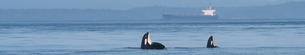
Naval Station Everett is ~6.5 km from the Mukilteo ferry terminal.

So, are there any vessels currently at Naval Station Everett that carry Mid-Frequency Active sonar?  Well, for starters it is the home port of our old friend the USS Shoup which just a few weeks ago emerged from 7-months of improvements in Seattle, including to its “combat systems.”  It seems likely that the Shoup was testing its AN/SQS-53C(V)4 Hull Mounted Sonar (or possibly an updated system).

Confirmation of Shoup sonar testing on 3/2/2012 from Navy Region Northwest:

We’ve received two responses from Sheila Murray, the External Relations Manager from Navy Region Northwest.

On 3/2/12 9:25 Sheila Murray wrote:

The Navy was conducting pierside testing of mid-frequency active sonar at Naval Station Everett yesterday. This is routine testing that is a longstanding and ongoing requirement, and is an essential process in preparing a Navy ship to get underway. Pierside testing is not continuous, but consists of very brief transmissions of acoustic energy interspersed with longer silent periods. Hopefully, this answers your question?

Respectfully,

Sheila Sheila Murray, External Relations Manager

Navy Region Northwest Public Affairs 1100 Hunley Rd. Silverdale,WA 98315

(W)360.396.4981/(BB)360.340.5398, sheila.murray@navy.mil

On 3/2/12 3:27 PM, Sheila Murray responded to further inquiries, adding these details:

After receiving approval from Commander Pacific Fleet, the Navy was conducting pierside testing of mid-frequency sonar equipment Wednesday afternoon…. USS Shoup was at Everett conducting pierside testing of mid-frequency active sonar Wednesday afternoon.

There are also other Navy vessels which make Everett their home port…  Or, was a U.S. submarine in the vicinity ensuring the path would be clear and safe for the inbound aircraft carrier USS Stennis which is due back in Bremerton this Friday around 11:30 a.m.?

There’s more acoustic analysis to be done about the potential effects of this new sonar incident, especially since harbor porpoises have been observed more frequently in the area and a grey whale was sighted simultaneous to the sonar use.  Susan wrote this afternoon on the Orca Network Facebook page:

“Yay!! Just saw a Gray whale from our office window, 4:35 pm! It appears to be feeding of the very tip of Fox Spit/East Pt, in Saratoga Passage, near the entrance to Holmes Harbor. I think it may be moving north, but not sure yet – cool!!”

Is the U.S. Navy “pinging in the pool” again, immediately after a new EIS is out for public scoping?

We’re still trying to assess whether damage was done by the sonar used by the Canadian Naval frigate Ottawa on 2/6/2012.  But first we have to walk the beaches again — this time in our own backyard — looking for injured marine mammals.

 Update on 3/2/2012 from Susan Berta of Orca Network:

The sonar continues today (Friday 3/2/2012).  Observers on a dock in Everett about 200 yards from a Naval ship that may have been doing the sonar testing heard pings that lasted about 10 seconds and described them as “REALLY LOUD.”  The Coast Guard boat FIR was anchored there again, but it is not clear if they are involved in the testing.

At 4:35 pm WSF operations reported that the Mukilteo/Clinton crew again began hearing sonar again today at 1400. They made some calls & were told sonar testing will continue today until 2200 and will take place again next Wednesday 3/7 and Friday 3/9.

We have had reports of a gray whale off Langley this afternoon, but are not sure how sonar impacts them.  The Navy is doing the testing near one of the Grays’ favorite feeding areas at a time the whales are definitely present.


 Update on 3/8/2012:

The home page of the Washington State Ferries has a link to this blog post within one of the three revolving highlights.  See screenshot below.  Apparently, their engineers have been complaining a lot about the sonar pings that they hear through the ferry hulls on the Mukilteo-Clinton route.

WA-ferry-website-link-screenshot

Screenshot of http://www.wsdot.wa.gov/ferries/ taken on 3/8/2012


NOAA’s search & tag cruise embarks

NOAA ship Shimad track for 2/16/12

NOAA ship Shimada track for 2/16/12

Last update — 3/2/2012, 10:00

Brad Hanson and his colleagues from the Northwest Fisheries Science Center, including Marla Holt and Dawn Noren, embarked today (2/16/12) from Newport, OR, aboard the NOAA ship Shimada (MMSI 369970147) to search for southern resident killer whales (SRKWs) along the outer coast of Oregon and Washington, and possibly California and British Columbia.  With luck, they will encounter members of J, K, or L pod over the next 3 weeks and be able to gather further information about the wintertime habitat and behaviors of these salmon-seeking orcas that frequent the Salish Sea during the summer.  It’s also possible they may learn more about what may have caused the death of L-112 who washed up at Long Beach (top of ship track map) on 2/11/12.

NPR offered a 1-minute prospectus for the cruise on 2/10/12, but it did not mention satellite tagging.  Instead it only indicated the normal activities would take place — towing hydrophones to listen for calls, whistles, and clicks, and scanning for whales visually with binoculars from the ship’s bridge.  In past winter cruises, they have deployed a small boat upon locating SRKWs to gather fecal and prey fragment samples.

This winter is the first they also have a permit in place to attach barbed satellite tags to specific SRKW individuals. A King 5 story on 1/25/12 suggested they do plan to deploy satellite tags during this cruise.  The question of whether the risks of tagging exceed the potential benefits has split the local research and conservation communities, with Brad advocating it’s worth it while Ken Balcomb of the Center for Whale Research said it’s not.

PDF assessing NWFSC permit (among others)

Candice Calloway-Whiting’s case for not tagging: 1) Added risk of fatalities from infections; 2) interference with care-giving by older females

Huffington Post article quoting Brad’s practical rational for tagging: 1) refining where acoustic detectors are placed and 2) offering new habitat use information to the transboundary orca-salmon meeting in Vancouver this March.

If you’d like to follow the Shimada’s progress this winter, one useful tool is the real-time Automatic Identification Service (AIS) data that is available through sites like http://marinetraffic.com  Today they zig-zagged up the coast at about 10 knots.  The forecast is for rough weather tomorrow (Friday) night, so expect to see the Shimada run for the more-protected waters of the Strait of Juan de Fuca.

Update: Monday 2/20/2012 1:10 a.m. (Pacific time)

After returning to Seattle briefly, presumably to wait out bad weather on the outer coast, the Shimada heads back out into the Strait of Juan de Fuca and is passing Race Rocks around midnight or 1 a.m. Pacific Time.

2/20: Shimada departs Seattle & Salish Sea

2/20: Shimada departs Seattle & Salish Sea

About 5 hours later (~6:00 a.m.)  J and possibly K pod calls are heard on the Lime Kiln hydrophones by Jeanne Hyde and Laura Swan.  There aren’t many fixes from AIS in the interim, but around noon the Shimada is moving east near the mouth of the Strait of Juan de Fuca.

Shimada steaming east at 7-10 knots around noon on 2/20

Sometime during daylight hours on 2/20/2012, the NOAA team tagged a J pod whale (J26, or Mike) that returned its first location around 1800. Here is a NOAA web page where the tagging data from SRKWs will be sharedhttp://www.nwfsc.noaa.gov/research/divisions/cbd/marine_mammal/satellite_tagging.cfm — and the first track posted there:

First J pod track

First track of a J pod whale with a satellite tag

And here is a summary of the first tagging event in 2012 by Chris Dunagan of the Kitsap Sun.

Updates on Shimada ship tracks — 2/21-23:

shimada-120221-1527

Shimada track on 120221 at 1527 Pacific time

No AIS data are easily available for the 24 hour period between 15:00 on 2/21 and 15:00 on 2/22.  Then the Shimada made a few passes within the Strait of Juan de Fuca between 15:00 on 02/22/2012 and 01:00 on 02/23/2012 (as shown in screengrab below).

Evening to midnight Shimada tracks on 2/22-23

Evening to midnight Shimada tracks on 2/22-23


Updates on 2/25/12:

The Shimada arrived in Port Angeles around 10pm local time on Friday 2/24/2012 to escape a storm that brought 45 knot wind gusts to the mouth of the Strait of Juan de Fuca (see AIS screengrab and plot below).

Shimada track into Port Angeles from 8pm local time on 2/24.

Shimada runs for Port Angeles at 13 knots from 8pm local time on 2/24.

35 knot winds send the Shimada to port on 2/25

Updates on 2/27/12:

The highlighted text was changed in this 2/27 screengrab of the NOAA orca tagging web site.  It indicates that the first tag provided data for only 3 days, though the group’s research permit states “Tags would be expected to stay attached for up to 25 weeks and are designed to release after one year.”  What a drag for Mike that so little data was transmitted…  At least he gave us an example of how far out on the shelf J pod goes, though (foraging?) at Swiftsure and La Perouse Banks is not new information.

Full track of J pod whale

3 day track of a J pod whale

The Shimada departed Port Angeles on 2/26/12 at 10 a.m. after weathering a storm.  The latest track (below, as of 03:00 on 2/27/2012) suggests that after crossing the Strait of Juan de Fuca, the NOAA team moved north at 5-8 knots from False Bay at around noon.  That could be a speed consistent with traveling killer whales, but no SRKW vocalizations were reported by humans on the San Juan Island hydrophones on 2/26/12 (though transient calls were heard at Lime Kiln around 17:00).  The Shimada proceeded at those speeds until reaching the south arm of the Fraser River where they turned around at about 19:00 and increased speed to 8-10 knots.  They passed False Bay going south at about midnight and then proceeded out the Strait of Juan de Fuca.

Screen Shot 2012-02-27 at 12.50.27 PM

Shimada track for 2/26-27/2012.

Updates on 2/28/12:

The Shimada began a search pattern today, zig-zagging south along the outer coast of Washington at about 8 knots.  The screengrab below shows their track from midnight until 4pm local time on 2/28/12.

Shimada track for 2/28/2012 00:00-04:00 Pacific time.

Shimada track for 2/28/2012 00:00-04:00 Pacific time.

The weather forecast suggests they’re in for a pretty rough ride, though weather is expected to moderate on Wednesday:

PZZ150-290200-
COASTAL WATERS FROM CAPE FLATTERY TO JAMES ISLAND OUT 10 NM-
849 AM PST TUE FEB 28 2012


…GALE WARNING IN EFFECT THROUGH THIS EVENING… TODAY…SE WIND 25 TO 35 KT. COMBINED SEAS 7 TO 10 FT WITH A DOMINANT PERIOD OF 14 SECONDS. RAIN.

TONIGHT…SE WIND 25 TO 35 KT…BECOMING S 15 TO 25 KT AFTER MIDNIGHT. COMBINED SEAS 10 TO 13 FT WITH A DOMINANT PERIOD OF 14 SECONDS. RAIN IN THE EVENING…THEN SHOWERS AFTER MIDNIGHT.

WED…S WIND 15 TO 25 KT. WIND WAVES 2 TO 5 FT. W SWELL 11 FT AT 15 SECONDS…BUILDING TO 14 FT AT 15 SECONDS IN THE AFTERNOON. SHOWERS LIKELY.

WED NIGHT…W SWELL 15 FT. W WIND 10 TO 20 KT. WIND WAVES 1 TO 3 FT.

Oops.  Looks like the turned back and as of Tuesday 2/28/2012 at 17:10 were searching in the more-sheltered Strait of Juan de Fuca

shimada-120228_1710

Scant AIS data suggest Shimada returning to Salish Sea.


Updates Wednesday 2/29/2012:


shimada-120228_1900-120229_0824

Shimada patrols Strait from 2/28 19:00 to 2/29 08:24

Shimada feb 29 2012

Marinetraffic.com data show the Shimada criss-crossed the shelf at 6-9 knots from 17:00-22:00 on Wed 2/29/2012.

The Shimada slowed to 3-4 knots near Sooke around 8 a.m. on Wednesday 2/29.  It is possible that the decrease in speed and changes of direction were related to an effort to observe the Bigg’s killer whales that were reported by Ron Bates on Orca Network’s Facebook page ~6-7 hours later: “T20 & T21 4.4 Nautical N.E of Race Rocks 1445.”

Siitech.com

Siitech.com AIS data for 2/29/2012 show a search pattern in the Strait of Juan de Fuca. Speed begins is mostly ~6 knots, but slows to 3-4 during direction changes near Sooke and increases to about 10 knots during return to inland waters.

Graphical synopsis of the first 2 weeks:

The NOAA team seems to have been concentrating on the Strait of Juan de Fuca in its search for killer whales the last two weeks.

Shimada ship tracks for first 2 weeks of February 2012 cruise.

Shimada ship tracks for first 2 weeks of February 2012 cruise.

NOAA's search pattern in the Strait of Juan de Fuca

NOAA's search pattern in the Strait of Juan de Fuca

Updates on 3/2/2012:

On 3/1 Orca Network reported on their Facebook Page this notice from John Ford:

A J pod sighting from yesterday, sent by John Ford of DFO’s Pacific Biological Station:
We observed J pod southbound off Nanaimo at 1800 yesterday (2/29). They were heading (south) towards Dodd Narrows when we left them at dark.

Shortly afterwards the Shimada returned from the shelf and began patrolling Active and Boundary Passes.

shimada-120229_1800-120301_1751

Shimada track for Wed 2/29 @ 1800 to Thur 3/01 @ 1751.

Subsequently, they have been cruising in that area and Georgia Strait, mostly at 6-8 knots, but with one burst near East Point at 12 knots.

shimada-120301-120302_0922

Shimada track 3/1 through 3/2 @ 09:22.