Category Archives: BR-rss

Canadian Navy responds to scientists’ stop-sonar letter

This morning we received the first official response to the letter from 20 marine scientists regarding silencing sonar in the Salish Sea.  The response (below) came from the head of the Canadian Navy — Peter MacKay, the Minister of National Defence in Canada — 60 days after receipt of the scientists’ letter.  It implies that discussions have been initiated between the Department of National Defence (DND), the Department of Fisheries and Oceans (DFO), and Environment Canada.  This seems to set the stage for re-evaluating how (or even whether) the Canadian Navy trains in the habitat of marine species of concern.

Dear Mr. Veirs:

Thank you for your email of March 1, 2012,
concerning military sonar operations in
the Salish Sea. 

I understand your concerns about the conduct of
military operations and training exercises and their
effect on critical habitat and the Southern Resident
Killer Whale population. To that end, subject matter
experts from the Department of National Defence (DND)
are working in consultation with staff at Fisheries
and Oceans Canada and Environment Canada. The goal is
to ensure that the best possible practices are in
place so that our activities are conducted in a
responsible manner with relation to the Fisheries Act
and the Species at Risk Act.  

Defending Canadians is a top priority for the Government
of Canada, and the Royal Canadian Navy (RCN) needs to
conduct regular exercises in our national maritime
approaches. These activities ensure RCN overall readiness
and familiarity with its primary area of operation. Being
conscious of our responsibilities to Canadians, the
environment, and its inhabitants, DND is dedicated to
continuously improving operational policies and procedures
to responsibly manage the impact of military activities.
This management will be based on the best scientific
information available at the time. 

I trust this is of assistance, and thank you for your
interest in the recovery and preservation of the Southern
Resident Killer Whales. Your recognition of the importance
of the national security role of the RCN is appreciated.

Sincerely,

Peter MacKay
Minister of National Defence

Sonar heard in Puget Sound – through WA State ferry!

Washington State ferry workers and passengers on the Clinton-Mukilteo route heard sonar sounds above water (presumably coming through the hull) that lasted for about an hour this afternoon (Wednesday 2/29/2012).  Jenny Atkinson, Executive Director of The Whale Museum said that the Washington State Ferries operations center had called the Musuem’s stranding/sighting hotline to report that the ferry workers on the Clinton-Mukilteo run were complaining about sonar noises this afternoon.  Dr. Jason Wood, a bioacoustician and Research Associate with the Museum, requested further details from the operations center and obtained this chronology:

  • 15:49 Approximate local Pacific time that sonar pings begin
  • 15:54 First call from ferry workers to operations center stating that sonar pings had started 5 minutes before.
  • 16:30 A second call is received saying pings are still loud in the ferry’s engine room
  • Total duration of sonar pinging was ~ 1 hour

He also learned that:

“The crew in the engine room, the captain, and passengers could hear the sonar, at times so loudly that the ferry agent on land could hear the sonar coming up through the ferry while it was at the dock…. The operations center called the Everett Naval base, but got no answers. They also called the coast guard. No naval or coast guard vessels were reported seen during the sonar incident, other than a naval vessel at the dock in the Everett Navy yard.”

However, Susan Berta and Howard Garrett of Orca Network had noticed a Coast Guard cutter on the marinetraffic.com real-time AIS web site the same afternoon “down between the south end of Camano Islands, Whidbey Island, and & Everett.”  Susan wrote “I can’t recall exactly what time, but it had to be mid-late afternoon – I remember looking on the map several times to see if there were any vessels in Saratoga Passage, and noticed a Coast Guard vessel in the south end of Saratoga Passage.”

Using the replay feature of the Siitech.com real-time AIS web site suggests that the vessel was the Coast Guard Cutter FIR (MMSI 369915000, see frame grab below).  However, this vessel appears to have been at anchor — at least in the early afternoon — and based on the listed characteristics, the CGC FIR does not carry an active sonar system.

Location of the Coast Guard cutter FIR

Location of the Coast Guard cutter FIR during the afternoon when sonar was heard.

With no other suspect vessels archived in the AIS data, we fall back to the likelihood that the U.S. Navy was involved.  Jason wonders “Is is possible that they would test sonar from the dock?”

Interestingly, Mike Francis of Oregonian foresaw that such “pierside testing” was likely to become a contentious issue when he wrote about the new Navy proposed EIS on Monday (2/27/2012).  The Federal Register also mentions that the Study Area of the proposed EIS would include “pierside locations” for testing.  After studying the lengthy EIS,  Mike pulled out this single quote:

“The Proposed Action includes pierside sonar testing conducted as part of overhaul, modernization, maintenance and repair activities at Puget Sound Naval Shipyard in Bremerton, Naval Base Kitsap at Bangor and Naval Station Everett.”

Naval Station Everett

Naval Station Everett is ~6.5 km from the Mukilteo ferry terminal.

So, are there any vessels currently at Naval Station Everett that carry Mid-Frequency Active sonar?  Well, for starters it is the home port of our old friend the USS Shoup which just a few weeks ago emerged from 7-months of improvements in Seattle, including to its “combat systems.”  It seems likely that the Shoup was testing its AN/SQS-53C(V)4 Hull Mounted Sonar (or possibly an updated system).

Confirmation of Shoup sonar testing on 3/2/2012 from Navy Region Northwest:

We’ve received two responses from Sheila Murray, the External Relations Manager from Navy Region Northwest.

On 3/2/12 9:25 Sheila Murray wrote:

The Navy was conducting pierside testing of mid-frequency active sonar at Naval Station Everett yesterday. This is routine testing that is a longstanding and ongoing requirement, and is an essential process in preparing a Navy ship to get underway. Pierside testing is not continuous, but consists of very brief transmissions of acoustic energy interspersed with longer silent periods. Hopefully, this answers your question?

Respectfully,

Sheila Sheila Murray, External Relations Manager

Navy Region Northwest Public Affairs 1100 Hunley Rd. Silverdale,WA 98315

(W)360.396.4981/(BB)360.340.5398, sheila.murray@navy.mil

On 3/2/12 3:27 PM, Sheila Murray responded to further inquiries, adding these details:

After receiving approval from Commander Pacific Fleet, the Navy was conducting pierside testing of mid-frequency sonar equipment Wednesday afternoon…. USS Shoup was at Everett conducting pierside testing of mid-frequency active sonar Wednesday afternoon.

There are also other Navy vessels which make Everett their home port…  Or, was a U.S. submarine in the vicinity ensuring the path would be clear and safe for the inbound aircraft carrier USS Stennis which is due back in Bremerton this Friday around 11:30 a.m.?

There’s more acoustic analysis to be done about the potential effects of this new sonar incident, especially since harbor porpoises have been observed more frequently in the area and a grey whale was sighted simultaneous to the sonar use.  Susan wrote this afternoon on the Orca Network Facebook page:

“Yay!! Just saw a Gray whale from our office window, 4:35 pm! It appears to be feeding of the very tip of Fox Spit/East Pt, in Saratoga Passage, near the entrance to Holmes Harbor. I think it may be moving north, but not sure yet – cool!!”

Is the U.S. Navy “pinging in the pool” again, immediately after a new EIS is out for public scoping?

We’re still trying to assess whether damage was done by the sonar used by the Canadian Naval frigate Ottawa on 2/6/2012.  But first we have to walk the beaches again — this time in our own backyard — looking for injured marine mammals.

 Update on 3/2/2012 from Susan Berta of Orca Network:

The sonar continues today (Friday 3/2/2012).  Observers on a dock in Everett about 200 yards from a Naval ship that may have been doing the sonar testing heard pings that lasted about 10 seconds and described them as “REALLY LOUD.”  The Coast Guard boat FIR was anchored there again, but it is not clear if they are involved in the testing.

At 4:35 pm WSF operations reported that the Mukilteo/Clinton crew again began hearing sonar again today at 1400. They made some calls & were told sonar testing will continue today until 2200 and will take place again next Wednesday 3/7 and Friday 3/9.

We have had reports of a gray whale off Langley this afternoon, but are not sure how sonar impacts them.  The Navy is doing the testing near one of the Grays’ favorite feeding areas at a time the whales are definitely present.


 Update on 3/8/2012:

The home page of the Washington State Ferries has a link to this blog post within one of the three revolving highlights.  See screenshot below.  Apparently, their engineers have been complaining a lot about the sonar pings that they hear through the ferry hulls on the Mukilteo-Clinton route.

WA-ferry-website-link-screenshot

Screenshot of http://www.wsdot.wa.gov/ferries/ taken on 3/8/2012


NOAA’s search & tag cruise embarks

NOAA ship Shimad track for 2/16/12

NOAA ship Shimada track for 2/16/12

Last update — 3/2/2012, 10:00

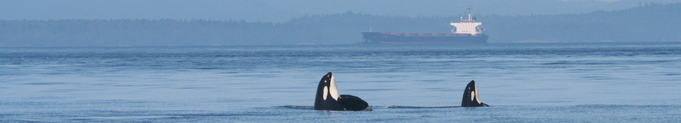
Brad Hanson and his colleagues from the Northwest Fisheries Science Center, including Marla Holt and Dawn Noren, embarked today (2/16/12) from Newport, OR, aboard the NOAA ship Shimada (MMSI 369970147) to search for southern resident killer whales (SRKWs) along the outer coast of Oregon and Washington, and possibly California and British Columbia.  With luck, they will encounter members of J, K, or L pod over the next 3 weeks and be able to gather further information about the wintertime habitat and behaviors of these salmon-seeking orcas that frequent the Salish Sea during the summer.  It’s also possible they may learn more about what may have caused the death of L-112 who washed up at Long Beach (top of ship track map) on 2/11/12.

NPR offered a 1-minute prospectus for the cruise on 2/10/12, but it did not mention satellite tagging.  Instead it only indicated the normal activities would take place — towing hydrophones to listen for calls, whistles, and clicks, and scanning for whales visually with binoculars from the ship’s bridge.  In past winter cruises, they have deployed a small boat upon locating SRKWs to gather fecal and prey fragment samples.

This winter is the first they also have a permit in place to attach barbed satellite tags to specific SRKW individuals. A King 5 story on 1/25/12 suggested they do plan to deploy satellite tags during this cruise.  The question of whether the risks of tagging exceed the potential benefits has split the local research and conservation communities, with Brad advocating it’s worth it while Ken Balcomb of the Center for Whale Research said it’s not.

PDF assessing NWFSC permit (among others)

Candice Calloway-Whiting’s case for not tagging: 1) Added risk of fatalities from infections; 2) interference with care-giving by older females

Huffington Post article quoting Brad’s practical rational for tagging: 1) refining where acoustic detectors are placed and 2) offering new habitat use information to the transboundary orca-salmon meeting in Vancouver this March.

If you’d like to follow the Shimada’s progress this winter, one useful tool is the real-time Automatic Identification Service (AIS) data that is available through sites like http://marinetraffic.com  Today they zig-zagged up the coast at about 10 knots.  The forecast is for rough weather tomorrow (Friday) night, so expect to see the Shimada run for the more-protected waters of the Strait of Juan de Fuca.

Update: Monday 2/20/2012 1:10 a.m. (Pacific time)

After returning to Seattle briefly, presumably to wait out bad weather on the outer coast, the Shimada heads back out into the Strait of Juan de Fuca and is passing Race Rocks around midnight or 1 a.m. Pacific Time.

2/20: Shimada departs Seattle & Salish Sea

2/20: Shimada departs Seattle & Salish Sea

About 5 hours later (~6:00 a.m.)  J and possibly K pod calls are heard on the Lime Kiln hydrophones by Jeanne Hyde and Laura Swan.  There aren’t many fixes from AIS in the interim, but around noon the Shimada is moving east near the mouth of the Strait of Juan de Fuca.

Shimada steaming east at 7-10 knots around noon on 2/20

Sometime during daylight hours on 2/20/2012, the NOAA team tagged a J pod whale (J26, or Mike) that returned its first location around 1800. Here is a NOAA web page where the tagging data from SRKWs will be sharedhttp://www.nwfsc.noaa.gov/research/divisions/cbd/marine_mammal/satellite_tagging.cfm — and the first track posted there:

First J pod track

First track of a J pod whale with a satellite tag

And here is a summary of the first tagging event in 2012 by Chris Dunagan of the Kitsap Sun.

Updates on Shimada ship tracks — 2/21-23:

shimada-120221-1527

Shimada track on 120221 at 1527 Pacific time

No AIS data are easily available for the 24 hour period between 15:00 on 2/21 and 15:00 on 2/22.  Then the Shimada made a few passes within the Strait of Juan de Fuca between 15:00 on 02/22/2012 and 01:00 on 02/23/2012 (as shown in screengrab below).

Evening to midnight Shimada tracks on 2/22-23

Evening to midnight Shimada tracks on 2/22-23


Updates on 2/25/12:

The Shimada arrived in Port Angeles around 10pm local time on Friday 2/24/2012 to escape a storm that brought 45 knot wind gusts to the mouth of the Strait of Juan de Fuca (see AIS screengrab and plot below).

Shimada track into Port Angeles from 8pm local time on 2/24.

Shimada runs for Port Angeles at 13 knots from 8pm local time on 2/24.

35 knot winds send the Shimada to port on 2/25

Updates on 2/27/12:

The highlighted text was changed in this 2/27 screengrab of the NOAA orca tagging web site.  It indicates that the first tag provided data for only 3 days, though the group’s research permit states “Tags would be expected to stay attached for up to 25 weeks and are designed to release after one year.”  What a drag for Mike that so little data was transmitted…  At least he gave us an example of how far out on the shelf J pod goes, though (foraging?) at Swiftsure and La Perouse Banks is not new information.

Full track of J pod whale

3 day track of a J pod whale

The Shimada departed Port Angeles on 2/26/12 at 10 a.m. after weathering a storm.  The latest track (below, as of 03:00 on 2/27/2012) suggests that after crossing the Strait of Juan de Fuca, the NOAA team moved north at 5-8 knots from False Bay at around noon.  That could be a speed consistent with traveling killer whales, but no SRKW vocalizations were reported by humans on the San Juan Island hydrophones on 2/26/12 (though transient calls were heard at Lime Kiln around 17:00).  The Shimada proceeded at those speeds until reaching the south arm of the Fraser River where they turned around at about 19:00 and increased speed to 8-10 knots.  They passed False Bay going south at about midnight and then proceeded out the Strait of Juan de Fuca.

Screen Shot 2012-02-27 at 12.50.27 PM

Shimada track for 2/26-27/2012.

Updates on 2/28/12:

The Shimada began a search pattern today, zig-zagging south along the outer coast of Washington at about 8 knots.  The screengrab below shows their track from midnight until 4pm local time on 2/28/12.

Shimada track for 2/28/2012 00:00-04:00 Pacific time.

Shimada track for 2/28/2012 00:00-04:00 Pacific time.

The weather forecast suggests they’re in for a pretty rough ride, though weather is expected to moderate on Wednesday:

PZZ150-290200-
COASTAL WATERS FROM CAPE FLATTERY TO JAMES ISLAND OUT 10 NM-
849 AM PST TUE FEB 28 2012


…GALE WARNING IN EFFECT THROUGH THIS EVENING… TODAY…SE WIND 25 TO 35 KT. COMBINED SEAS 7 TO 10 FT WITH A DOMINANT PERIOD OF 14 SECONDS. RAIN.

TONIGHT…SE WIND 25 TO 35 KT…BECOMING S 15 TO 25 KT AFTER MIDNIGHT. COMBINED SEAS 10 TO 13 FT WITH A DOMINANT PERIOD OF 14 SECONDS. RAIN IN THE EVENING…THEN SHOWERS AFTER MIDNIGHT.

WED…S WIND 15 TO 25 KT. WIND WAVES 2 TO 5 FT. W SWELL 11 FT AT 15 SECONDS…BUILDING TO 14 FT AT 15 SECONDS IN THE AFTERNOON. SHOWERS LIKELY.

WED NIGHT…W SWELL 15 FT. W WIND 10 TO 20 KT. WIND WAVES 1 TO 3 FT.

Oops.  Looks like the turned back and as of Tuesday 2/28/2012 at 17:10 were searching in the more-sheltered Strait of Juan de Fuca

shimada-120228_1710

Scant AIS data suggest Shimada returning to Salish Sea.


Updates Wednesday 2/29/2012:


shimada-120228_1900-120229_0824

Shimada patrols Strait from 2/28 19:00 to 2/29 08:24

Shimada feb 29 2012

Marinetraffic.com data show the Shimada criss-crossed the shelf at 6-9 knots from 17:00-22:00 on Wed 2/29/2012.

The Shimada slowed to 3-4 knots near Sooke around 8 a.m. on Wednesday 2/29.  It is possible that the decrease in speed and changes of direction were related to an effort to observe the Bigg’s killer whales that were reported by Ron Bates on Orca Network’s Facebook page ~6-7 hours later: “T20 & T21 4.4 Nautical N.E of Race Rocks 1445.”

Siitech.com

Siitech.com AIS data for 2/29/2012 show a search pattern in the Strait of Juan de Fuca. Speed begins is mostly ~6 knots, but slows to 3-4 during direction changes near Sooke and increases to about 10 knots during return to inland waters.

Graphical synopsis of the first 2 weeks:

The NOAA team seems to have been concentrating on the Strait of Juan de Fuca in its search for killer whales the last two weeks.

Shimada ship tracks for first 2 weeks of February 2012 cruise.

Shimada ship tracks for first 2 weeks of February 2012 cruise.

NOAA's search pattern in the Strait of Juan de Fuca

NOAA's search pattern in the Strait of Juan de Fuca

Updates on 3/2/2012:

On 3/1 Orca Network reported on their Facebook Page this notice from John Ford:

A J pod sighting from yesterday, sent by John Ford of DFO’s Pacific Biological Station:
We observed J pod southbound off Nanaimo at 1800 yesterday (2/29). They were heading (south) towards Dodd Narrows when we left them at dark.

Shortly afterwards the Shimada returned from the shelf and began patrolling Active and Boundary Passes.

shimada-120229_1800-120301_1751

Shimada track for Wed 2/29 @ 1800 to Thur 3/01 @ 1751.

Subsequently, they have been cruising in that area and Georgia Strait, mostly at 6-8 knots, but with one burst near East Point at 12 knots.

shimada-120301-120302_0922

Shimada track 3/1 through 3/2 @ 09:22.


Canadian recovery plans need public comment

Thanks to Cathy Bacon for forwarding this notice regarding Canadian “action plans” for recovering the northern and southern resident killer whale populations. It will be interesting to see to what extent managing salmon (farmed or wild) for killer whales is mentioned in the plans… Discuss here and comment officially when you can!

> From: “XPAC Species at Risk”
> Date: January 18, 2012 11:35:42 AM PST
> Subject: Resident Killer Whale Action Planning process Consultations
>
> Microsoft Word PictureFisheries and Oceans Canada Pêches et Océans Canada
>
> January 18, 2012
>
> Picture (Metafile)
>
> To: Stakeholders, Interested Individuals, and Organizations:
>
> Re: Northern and Southern Resident Killer Whale Action Planning process Consultations
>
> Fisheries and Oceans Canada (DFO) is pleased to invite you to participate in consultations on the development of the Northern and Southern Resident Killer Whale Action Plan. We are interested in your feedback as we develop and prioritize actions in support of recovery of Resident Killer Whale populations in Canadian Pacific waters.
>
> The Minister of Fisheries and Oceans Canada is required to develop a recovery strategy and action plan for all threatened or endangered aquatic species listed under the Species at Risk Act (SARA), and appreciates your input. Northern and Southern Resident Killer Whales are listed as Threatened and Endangered respectively, and a recovery strategy for these populations is posted on the SARA National Registry: http://www.sararegistry.gc.ca/species/speciesDetails_e.cfm?sid=699
>
> If you would like to know more about the Northern and Southern Resident Killer Whale populations and how their recovery may affect you, or if you would like to provide comments on the draft actions supporting recovery of these populations, we will be conducting meetings during the month of February (open house from 6:00 pm to 7:00 pm; public meeting from 7:00 pm to 9:00 pm).
>
> February 2, 2012 Victoria, BC The Maritime Museum of BC
> February 9, 2012 Vancouver, BC Vancouver Maritime Museum
> February 23, 2012 Port Hardy, BC Quarterdeck Inn Marina Resort
>
> Please see http://www.pac.dfo-mpo.gc.ca/consultation/sara-lep/index-eng.htm for further information, or contact us directly at the numbers below.
>
> Sincerely,
>
> Sheila Thornton Paul Cottrell
> SARA Recovery Planner Marine Mammal Coordinator
> Fisheries and Oceans Canada Fisheries and Oceans Canada
> 200-401 Burrard Street 200-401 Burrard Street
> Vancouver, BC V6C 3S4 Vancouver, BC V6C 3S4
> Tel: 604-666-2043 Tel: 604-666-9965
> Fax: 604-666-3341 Fax: 604-666-3341

Salmon virus spin

The science of monitoring west coast salmon populations for infectious salmon anemia is getting drowned out by spin and counterspin in Canadian and U.S. media. As an example of what Alexandra Morton calls a “cover-up”, compare the following pieces — both from Dec 6, 2011 — from the L.A. Times blog and Food Safety News.

Did Canada cover up deadly salmon virus? Report suggests yes

No ISA Found in BC Pacific Waters, Canada Says

With luck, clarity will emerge from the special sessions of the Cohen Inquiry scheduled for December 15, 16, & 19.  In the mean time, it would be great to know what exactly is being done by Cantwell and U.S. scientists about conducting independent testing of the salmon in U.S. waters…

Condit dam removal video and fact archive

This is an excellent overview of the Condit Dam history with a focus on salmon recovery and preparations for the removal (from the dam owner PacifiCorp by Narrative Lab).

One interesting point made in the video is that the reservoir was expected to drain in 6 hours (it drained in only 1 hour). And here are some quotes that have implications for how the recovery of the Elwha Chinook…

“Most of these fish are 25, 30 — we moved a 45 pound fish…. Tule fall Chinook are also known as White Salmon. They’re big because they had to move big cobble and big gravel.”

Perhaps we should be considering stocking the Elwha with such monsters instead of hoping the scarce or extinct spring run is replaced slowly by the hatchery-maintained fall run?

This coverage by Sally Showman of KOINLOCAL6 does a nice job of adding sound to the PacifiCorp and American Rivers breach footage, and also captures the wide range of emotional responses from local people.

And some nice footage of the rapid erosion of the reservoir sediments from Josh Epstein:

And time lapse videos by the University of Montana geomorphology lab and the USGS:

Other recent press:

http://www.columbian.com/news/2011/oct/27/condit-dam-projections-reality-studied-following-b/

Connecting the Fraser salmon virus dots

Are the Fraser chinook that southern resident killer whales love to eat already infected by the Infectious Salmon Anemia virus (ISAV) just detected in 2 Fraser sockeye smolts?  Could this virus — not salmon leukemia — be what caused the the mortality-related genomic signature in Fraser sockeye reported earlier this year?

Remember that DFO scientist Miller-Saunders told Scientific American last spring that “there is some indication that the signature may be in Chinook and coho” salmon, too.  To what data was she referring, I wonder?  Was it derived from out-migrating smolts or returning adults, wild or hatchery fish?  Was she referring to Fraser Chinook and coho, or some other stocks?

In contemplating how ISAV may affect the Northeast Pacific ecosystem, the Final Recovery Plan for U.S. Atlantic Salmon (Gulf of Maine DSP, 2005) is truly frightening reading.  The section on ISAV (appended below) suggests: that the virus can kill 3-50% of each production cycle and can infect non-Atlantic salmon (coho salmon in Chilean pens), as well as non-salmonids like rainbow trout (cultured) and gadids (potentially our pollack and cod species!); that rainbow and brown trout can be asymptomatic vectors; and that wild Atlantic salmon have been infected.  The plan also notes that “sea lice have been shown to retain the ISA virus after feeding on infected salmon.”  That’s pretty troubling when juxtaposed with recent research on lice infestation of wild B.C. salmon

The outlook for the Salish Sea ecosystem (and particularly it’s endangered salmon stocks) looks even dimmer after perusing an article about experimental infection of herring with ISAV.  The take home message (from the abstract): “It is concluded that the ISA virus is able to propagate in herring and that the herring may be an asymptomatic carrier of the virus.”

It’s going to be fascinating (and probably depressing) to see whether a pandemic develops.  If it does, the long-term outlook for southern resident killer whales may be bleak, especially if DFO fails to act at least as quickly and rigorously with the salmon farming industry as the U.S. agencies did when attempting to control the initial outbreaks in Maine.

Excerpt from the Final Recovery Plan for U.S. Atlantic Salmon (Gulf of Maine DSP, 2005) starting on page 1-60 —

ISA is a contagious and untreatable viral disease that affects a fish’s kidneys and circulatory system with a variable mortality rate from 3% to more than 50% in one production cycle (USDA APHIS 2001). Atlantic salmon infected with clinical ISA are anemic, typically lethargic, swim near the surface and fail to swim upright. Experimental studies have demonstrated that the virus is transmissible through mucous, feces and blood of infected/diseased fishes (Nylund et al., 1994). This results in cultured fishes being particularly susceptible to exposure to ISAV by infected cagemates. Studies in Norway indicate that penned salmon populations held within five kilometers (km) of each other or the discharge of slaughter wastes are at greatest risk of contracting ISA (Jarp and Karlsen, 1997). There is no evidence that the virus spreads vertically (from parents to offspring) although poor disinfection of fertilized eggs may allow for external transfer of the virus. Poor culture practices in fish hatcheries and net-pens in an Atlantic salmon watershed could increase the risk of a wild population’s exposure to disease.

ISA is the most significant known disease threat to the DPS. The threat of ISA to the recovery of the DPS is both direct, through infection of wild fish, and indirect by compromising hatchery supplementation of the DPS. The infection of emigrating smolts or adults passing near infected net-pens may cause mortality. This risk is greatest in those rivers whose approaches are nearest the highest concentration of net-pens, specifically the Dennys, East Machias and Machias. Other DPS river populations may also be at risk if they migrate through areas where aquaculture facilities are concentrated.

ISA has the potential to compromise CBNFH and the GLNFH if ISA-infected fish are inadvertently brought into one of these facilities. For example, an ISA-infected salmon brought into CBNFH for broodstock purposes could potentially infect other fish at the facility. In fact in 2001, a Penobscot sea run salmon brought to CBNFH for use as broodstock initially tested positive for ISA. Subsequent tests were negative and no additional fish were found to be infected. Outbreaks of ISA in freshwater hatcheries have not been reported from major salmon producing countries that have experienced ISA outbreaks. Still the potential for juveniles that have never entered salt water to be carriers of the virus is currently unknown.

ISA has already had an impact on Atlantic salmon recovery efforts. An adult stocking experiment (see page 4-69) was not fully optimized due to ISA concerns. These concerns resulted in more than 50% of the net-pen reared broodstock being destroyed. This decision was made because fish health experts felt the close proximity of these fish to fish infected with the ISA virus (ISAV) in commercial aquaculture pens was a substantial risk to wild populations. This concern was later affirmed by the outbreak of ISA in marine pens in the Cobscook Bay region (see page 1-82).

ISA was first reported in Norway in 1984 (Thorud and Djupvik 1988). In more recent years, cases of the disease have been reported from eastern Canada (Mullins et al. 1998), Scotland (Rodger et al. 1998), the Faroe Islands (OIE 2000), and in Cobscook Bay, Maine (Bouchard et al. 2001). The virus has also been associated with disease in cultured coho salmon in Chile (Kibenge et al. 2001) and very recently has been detected in cultured rainbow trout in Ireland.

The ISA virus has been known to cause disease in cultured fishes, principally in Atlantic salmon, although other species may act as carriers of the virus without signs of the disease. Species other than Atlantic salmon can become infected with ISAV and must be considered in the epizootiology of outbreaks and management of ISA. In laboratory studies, brown trout (Salmo trutta) and rainbow trout (Oncorhynchus mykiss) have been shown to be asymptomatic carriers of the ISA virus that can transmit the virus to salmon by co-habitation (Nylund and Jakobsen 1995; Nylund et al. 1995; Nylund et al. 1997). Escaped or caged rainbow trout may pose a threat to wild Atlantic salmon by serving as a reservoir of ISAV.

Recent studies in the United States and Canada indicate non-salmonids (i.e., gadids) can become infected with ISAV. Whether these species act as reservoirs in wild populations remains to be determined. Assays of non-salmonid fishes taken from pens containing ISA-diseased cultured Atlantic salmon resulted in isolation of virus from tissues of asymptomatic cod (MacLean et al. 2003).

Results of recent studies conducted in Scotland and Canada indicate that ISAV exists at a low level in wild salmonids. ISAV has been found in Atlantic salmon aquaculture escapees (Olivier 2002; Raynard et al. 2001). There has been one case of wild salmon exhibiting ISA in Canada, but these wild fish were confined in a trapping facility with infected salmon of aquaculture origin.

At the time of the listing of the DPS as endangered in December 2000 (65 FR 69459), some U.S. net-pen sites in Cobscook Bay, the location of Maine’s greatest concentration of salmon aquaculture pens, were within five km of Canada’s ISA positive sites, raising concerns about the potential for this disease to infect U.S. aquaculture and wild salmon stocks. Subsequent to the listing of the Gulf of Maine DPS of Atlantic salmon as endangered, the disease spread to U.S. aquaculture sites within Cobscook Bay. The first known case of ISA in Maine occurred in Cobscook Bay at a salmon aquaculture net-pen site. The infection probably occurred in 2000 and was confirmed in February 2001. By September 2001, 50% of the net-pen sites in Cobscook Bay were ISAV-infected or diseased.

In January 2002, in an effort to control a catastrophic outbreak of ISA in Cobscook Bay, the Maine Department of Marine Resources (DMR), with the assistance of the U.S. Department of Agriculture’s Animal and Plant Health Inspection Service (USDA/APHIS), ordered the destruction of an estimated 1.5 million cultured salmon in the Bay. The industry was required to remove all fish from the Bay and a fallowing period, between sixty and ninety days, was imposed for the entire Bay in an attempt to eradicate the disease. The industry was also required to remove, clean and disinfect all the associated net-pens, barges and equipment at all the farms. The January 2002 order followed the voluntary removal by the aquaculture industry of nearly one million ISA- infected or exposed fish. In March 2002, ISA was also detected in an aquaculture facility in Passamaquoddy Bay. In response, the DMR issued an eradication order for the approximately 140,000 fish at the site.
In response to the ISA outbreak in Cobscook Bay, Maine DMR implemented new fish health regulations. The new DMR rules include mandatory surveillance and reporting of all test results for ISAV in salmon culture facilities. Sites with confirmed presence of ISAV are automatically subject to a remedial action plan developed by the DMR in cooperation with the salmon growing industry. Under the new regulations, the movement of vessels and equipment is also restricted. Prior to the rule changes, surveillance was not mandatory and reporting was only required when a case of the disease was confirmed.

The new rules require monthly sampling for all active finfish facilities in Cobscook Bay and quarterly testing for aquaculture facilities elsewhere in Maine. Reporting of results is mandatory and reports are provided to DMR. The DMR can require monthly testing for finfish facilities outside of Cobscook Bay if a positive case of ISAV is detected. The new rules expand DMR’s authority to take action at not only infected facilities, but also those exposed to ISAV. The rules require DMR to consult with all relevant state and federal entities with expertise in ISA control to keep ISA from spreading and prevent further outbreaks.

In response to the ISA outbreaks, the Maine DMR, with assistance of the USDA/APHIS also implemented an ISA control and indemnity program for farm-raised salmon in the U.S. The funds provided by the USDA were used to help the State of Maine with epidemiology and surveillance, and to indemnify the industry for their losses due to ISA. Under the DMR rule, all salmon growers in Maine must participate in the program. The goal of this program is to control and contain the disease through rapid detection and depopulation of salmon that have been infected with or exposed to the ISA virus.

In Spring 2002, Maine DMR authorized the restocking of Cobscook Bay. The Bay had lain fallow since January 2002. This authorization followed USDA approval of the cleaning and disinfection of equipment and the fallowing period. Subsequent to approval, the aquaculture industry stocked 1.9 million smolts on seven farms in Cobscook Bay. The number of smolts stocked was 30% lower than the amount historically stocked in this area (DMR 2002). New husbandry standards have also been put in place as part of the ISA control program. These new standards are administered by DMR.

The ISA control program initially divided Cobscook Bay into two management areas, a southern and a northern zone. The southern zone was stocked in even years beginning in Spring 2002. The northern zone was stocked only in odd years, beginning in Spring 2003. Recently, USDA and Maine DMR have determined that the entire Cobscook Bay would be managed as a single area. DMR estimated that by there would be approximately 25% fewer fish in Cobscook Bay compared to previous levels. In addition, several conditions are required for each lot of smolts that are introduced into net-pens from freshwater hatcheries. All aquaculture facilities in Cobscook Bay are only permitted to raise a single-year class of fish. A minimum thirty-day fallowing period between production cycles is required. No more than 10% of the fish at a site may be carried over between production cycles and then only upon approval by DMR. This approval requires that no ISA is detected at the site during the production cycle, that general fish health is satisfactory, that fish are removed by September 1, and that there be a biweekly surveillance of the site by a fish health professional. Movement of fish between farms in the same zone requires a permit and verification that ISAV has not been detected at either site in the four weeks prior to movement. There will be no moving of fish between zones. In addition, farms, aquaculture vessels and processing plants are subject to routine third-party biosecurity audits. Despite these measures, additional cases of ISAV were detected at aquaculture sites in Cobscook Bay beginning in June 2003 and continuing in 2004.

The DMR’s bay management program was developed following an evaluation of other bay management and ISA control programs in Canada, Ireland, Scotland and Norway. These nations have developed control programs intended to prevent further outbreaks of the disease. The DMR plans to codify bay management husbandry standards in a rule and establish other bay management areas where finfish leases are located. Successful sea lice management and control is a necessary component of bay area management as sea lice have been shown to retain the ISA virus after feeding on infected salmon (Nylund et al. 1993).

During routine surveillance of all salmon culture sites in Maine, an apparently new strain of ISAV was detected in November 2003 at a site approximately 50 miles from Cobscook Bay. This was the first detection of ISAV at any site in Maine other than Cobscook Bay. The new strain did not cause disease in the cultured salmon and did not grow in the laboratory on various cell lines typically used in ISA isolation. Gene sequencing of this organism indicates it is more closely related to a Norwegian strain than the New Brunswick strain that has caused the mortalities in Cobscook Bay. Subsequently, this new strain has also been found in Cobscook Bay sites. Efforts are underway to sequence archived samples to determine the significance of the virus in the Cobscook Bay system.

One potential mode of disease transmission is through biological sampling conducted by various state and federal agencies in DPS rivers. The development and implementation of disinfection and biosecurity protocols reduces the risk of a pathogen being moved from one location to another (G. Russell Danner, IF&W fish pathologist, personal communication 2004). Disinfection and biosecurity protocols, where not already in place, should be developed and implemented for all research and sampling activities taking place in rivers within the DPS (see page 4-63).

Updates from NOAA on Elwha science

Yesterday Sarah Morely of NOAA/NWFSC Watershed Program, Fish Ecology Division gave a 40-minute synopsis of the “Elwha River Dam Removal – Past, Present, Future.”  My notes are appended and the NOAA site has an abstract with recommended references (also appended in case the link breaks).

A small (fall) Elwha chinook (dated Oct 4, 2010)

The most interesting aspect of the talk from the perspective of the southern resident killer whales is that no one in the audience, including Mike Ford, offered a clear articulation of the strategy for recovering the Elwha’s chinook salmon — and particularly the possibly extinct spring chinook of 50-kg fame.  Given their strong preference for big chinook (Hanson et al., 2010), the southern residents would presumably benefit most from the fast recovery of the biggest Elwha chinook, but Sarah only indicated that her impression was that the return of salmon to the Elwha was going to more “natural” than managed.  With large salmon and a combined species population potential of ~400,000 fish, we ought to be very clear as a community about the chinook recovery strategy!

That led one audience member to wonder whether the spring run is really extinct and, if so, how long it might take the fall chinook population to naturally fill the spring niche.  He asked whether 25 years might be a good guess for natural recovery of the spring chinook runs if adults are not moved above Glines Canyon dam to facilitate their re-colonization of the upper Elwha and tributaries (as is currently being done at Condit Dam on the White Salmon), but Sarah didn’t volunteer a confirmation or an alternative estimate.  The audience member’s suggestion of possible extinction is echoed on the National Park Service’s web page on the historic range of Elwha chinook:

Very few, if any, spring-run Chinook remain in the Elwha.

This made me realize that I (or some other southern resident stewards) need to dig into the EIS and figure out if the spring chinook are being managed in an optimal way from the perspective of the salmon-eating killer whales.  If they are not, then perhaps we should all make it a priority to change the situation.

In sleuthing around for details on the Elwha chinook runs, I did start to answer a different long-standing question: “Why were the Elwha chinook so big?”  I had heard 2 compelling hypotheses: (1) velocity and vertical barriers are more substantial on the Elwha than on comparable (Olympic) rivers and selected for fish powerful enough to surmount them; and, (2) stream bed gravel size in the Elwha is much larger than on comparable (Olympic) rivers and only bigger salmon could dig in it to build their redds.

The second is refuted by Sarah’s response to a question I asked her after her talk: How does the sediment size distribution in the upper Quinalt compare with that in the upper Elwha?  She said the upper (east?) fork of the Quinalt was chosen as a comparison site because the river bed sediment size distribution is similar to that in the upper Elwha.  Yet the Quinalt does not host gigantic chinook…  But perhaps it has bigger velocity and vertical barriers than the Elwha?

The first hypothesis is addressed in Brenkman et al., 2008 (special issue of Northwest Science).  They describe the velocity and vertical barriers on the Elwha:

The 7.9 km of main stem habitat currently available to anadromous salmonids in the Elwha River will increase to 71 km following dam removal. Possible seasonal velocity barriers exist in three main stem Elwha River canyons during periods of high river flows (Figure 2)—Rica (rkm 26.1 to rkm 27.3), Grand (rkm 31.1 to rkm 35.3), and Carlson Canyons (rkm 53.0 to rkm 54.5). Rica Canyon consists of bedrock, large boulders, and high-velocity water with several cascades and falls up to 1.8 m in height. The upstream portion of Grand Canyon contains several cascades and low waterfalls, and the lower 2.4 km of Grand Canyon contains approximately 15 cascades and falls. Carlson Canyon has a single waterfall that is 2 m in height (Washington Department of Fisheries 1971).
Seasonal velocity barriers in the Elwha River occur where the river channel is constrained by steep canyon walls and boulder- and bedrock- dominated substratum. Canyon reaches have channel gradients that are up to two times steeper (2% in Rica, Grand, and Carlson Canyons) than the average gradient for the entire 69 km of the main stem river (1%). High-flow events resulting from early winter storms and spring runoff create high-velocity cataracts that may constitute seasonal migration barriers to salmonids moving upstream. In contrast to these steep canyons, other sections of the Elwha River are much more gradual, with gradients of 0.3% from the mouth to Elwha Dam, 0.8% from Elwha Dam to Glines Canyon Dam, and 1.4% from Glines Canyon Dam to the headwaters of the main stem.

While salmon are generally capable of jumping 1.8-2m barriers, their ability to do so is limited by the pool size (particularly depth), relative position of the pool and the hydraulic jump, and degree of aeration in the pool.  I’ve yet to find these details, but if they don’t exist, I know what I’m doing on my next hike up the Elwha drainage!

MY NOTES ON THE TALK:

Sept 16 was beginning of deconstruction of dams. Deconstruction will take another 2-3 days. Salmon recovery is expected to take decades.

Background:

Global distribution of dams and reservoirs is extensive in termparate regions. Global Water System Project Database, 2011 (McGill University)

Poff & Hart, 2002, Bioscience: increased dam removal over last 30 (now 40?) years is due to replacement generally being more expensive than removal, BUT most removed dams have been small.

Imminent NW removals – Elwha, White Salmon, Sandy River, Marmot Dam on Little Sandy River, Rogue, Calapooia (Umpqua), Kalamat

Lower Elwha (190? 1913) and Glines dams (1932? 1927) reduced sediment, river movement, woody debris, as well as salmon populations. They will be removed concurrently in controlled increments over 2-3 years (to minimize impacts of sediment to fish as well as benthic organisms.

Link to web cam of sediment plume? (Bureau of Reclamation is managing erosion of 18 M m^3 of sediment, 50% fine, 30% coarse, suspended sediment concentrations of >10,000 ppm)

Monitoring efforts and objectives

Objectives: 1) Establish baselines (advanced) and 2) evaluate response to dam removal (just getting started)

Research areas: Former reservoirs, Nearshore (consortium of Fresh/Kagley/+), River ecosystem

Nearshore (slides from Kurt, but also USGS+ collaborators)

  • Monthly sampling (Mar-Sep) since 2006; 37m beach seine plus environmental data
  • Community composition doesn’t change much between years, but is a little different between their reference areas and the area expected to be impacted by sediments.

River ecosystem (Floodplain dynamics, aquatic foodwebs, fish recolonization [enumeration, distribution, predicted movements, genetic work])

Floodplain dynamics Pess, Beechie, LEKT, USGS, USFWS

  • Channel age, connectivity, distribution
  • Riparian vegetation diversity
  • Kloehn et al 2008, Influence of dams on river-floodplain dynamics in the Elwha River, Washington. Northwest Science 82.
  • Trout dominate surface water channels; Coho dominate in groundwater channels.
  • George snorkels to measure residual pool depth, pebble counts and spawnable area and fine sediment sampling.
  • 14 monitoring sites (7 below Elwha, 7 above Elwha; 2 mainstem, 2 tributaries, 10 floodplain)

Aquatic Foodwebs

  • Morley, Coe, LEKT, USGS
  • Nutrient Limitation, primary production, benthic invertebrate, marine derived nutrient transfer
  • Morley et al. 2008. Benthic invertebrate and periphyton in the Elwha River basin: current conditions and predicted response to dam removal. Northwest Science 82.
  • Duda et al., 2010. Isotope patterns.
  • River is nutrient limited in non-winter months by nitrogen and secondarily phosphorous
  • Elwha Fish Weir (species, sex, length, Tags (CWT, ?), scales, fin clip
  • Blue View (Keith Denton and 1 other) is helping with enumerating Coho when fish weir is non-functional in high flow periods.
  • Genetics of O. mykiss (resident rainbow and steelhead): see 3 gene pools or distinct populations: 3 native, 1 non-native (lower, resident, Trout Lake); no hatchery influence upstream of dams.
  • McMillan looking at resident rainbows vs anadromous steelhead metrics.
  • Kinsey Frick: Spawning movements of adult salmonids during dam removal. Catching fish in weir, tagging with radio tags, and releasing above
  • 20 chinook released above dam; relocated 3-4 that had found spawning habitat in lower Elwha while some returned to spawn below the dam. Plans to tag more chinook as well as other salmonids.

On-line resources

11:45 — QUESTION AND ANSWER SESSION:

  • Do you have plans to monitor hatchery stock status and impacts? At recent symposium, Norm Dicks mentioned that Chambers Creek (non-native steelhead) may be an issue, plus it is also focus of current law suit.
  • There used to be spring and fall chinook. The spring were the big ones and likely are extinct. Will spring chinook be brought in or are fall chinook expected to fill in that gap?
  • Me: How will chinook recovery be managed? Why was this approach taken, while more direct facilitation was done on White Salmon?
  • The Condit removal is supposed to take 3-5 days; why should the Elwha take so much longer?
Big Elwha salmon

Big Elwha salmon (from LEKT?)

Questions I didn’t ask:

  1. What is evidence of 100 lb chinook? Have all sources of evidence been pursued? (Middens? Interviews? Historic photographs? Written accounts? Inference from tree ring growth rate and/or isotope ratios?)  What is the source and story of the photo in your title slide (shown at right and credited to LEKT = Lower Elwha Klallum Tribe)?
  2. Are sediment size distributions similar in Quinalt to in the Elwha? Are such distributions governing invertebrate community structure?
  3. Why is recovery expected to take decades? (Urgency is lent by the SRKW’s need and preference for chinook.)

Follow research to do:

  • Frick re plans for upper Glines?
  • Is “out-planting” mentioned in the EIS?
  • Ask Eric Anderson how long fall chinook would take to fill niche of spring chinook.
  • Surely there are studies of how fast adaptation occurs from other removals or mitigation efforts?
  • How much sediment is behind Condit?

Clipping from the NWFSC talk announcement web site:

Elwha River Dam Removal: Past, Present, and Future

Date and Time: October 06, 2011, 11:00-12:00 Pacific Time Zone [Check U.S. Time clock for your local time]
Location: NOAA Northwest Fisheries Science Center (NWFSC) (2725 Montlake Boulevard East, Seattle, WA 98112; Map to NWFSC), Room: Auditorium.
Speaker(s): Sarah Morley (Research Ecologist, Watershed Program, Fish Ecology Division, NOAA NWFSC)
Speaker’s Email: sarah.morley@noaa.gov
OneNOAA Seminar Sponsor: NOAA NWFSC Monster Seminar JAM
Abstract: The removal of the Elwha River dams on the Olympic Peninsula of Washington State is a unique opportunity to examine ecosystem recovery on a watershed scale, and has spurred collaborative research efforts among divergent groups. For the past century, the two dams have blocked the upstream movement of anadromous fish to over 90% of the watershed, and restricted the downstream movement of sediment, wood, and other organic materials to the lower river and estuary. Populations of all five Pacific salmon species and steelhead in the Elwha are critically low, habitat complexity decreased in the middle and lower river, and downstream coastal habitats are sediment starved. Simultaneous deconstruction of the two dams began in September 2011 and will take three years to complete. During and after that time, researchers are examining dam removal effects in three geographic regions: the soon-to-be former reservoirs, across the river floodplain, and in the nearshore environment. Short-term (< 3 years post dam removal) monitoring is focused on the projected downstream transport of approximately four million cubic meters of fine sediments accumulated in the reservoir deltas, associated peaks in river and estuary turbidity levels, and re-vegetation of the reservoir themselves. Longer-term effects of dam removal (> 5 years) to be evaluated are the delivery of gravels and cobbles to the lower river and nearshore, the re-establishment of a natural wood delivery regime, the re-colonization of the upper watershed by anadromous fish, and the associated effects on aquatic and riparian foodwebs. This talk will provide an overview of the Elwha restoration project, but particularly highlight the research of NWFSC researchers examining river floodplain dynamics, salmon re-colonization, and aquatic foodwebs. The removal of the Elwha Dams has been long awaited by the Lower Elwha Klallam Tribe and others and will provide ongoing learning opportunities for future dam removal efforts across the United States and elsewhere.
About the Speaker: Sarah Morley is a field ecologist whose research focuses on biological assessment-using biota to evaluate the condition of a place and better identify the causes of degradation. Within this broad framework, she has conducted research on the effects of urbanization on the health of Puget Sound streams and evaluated the effectiveness of restoration actions on streams and rivers across the Pacific Northwest. Recent projects include examining the effects of shoreline armoring on the biota of the Duwamish River estuary, the effectiveness of green stormwater management strategies in improving urban stream health, and aquatic foodweb effects of dam removal on the Elwha River. Sarah holds a B.S. in Environmental Science from U.C. Berkeley and an M.S. in Aquatic and Fisheries Sciences from the University of Washington. She has been a member of the Watershed Program at the Northwest Fisheries Science Center since 2000. http://www.nwfsc.noaa.gov/research/staff/display_staffprofile.cfm?staffid=649

Salient Publications

  • Duda, J. J., H. Coe, S. A. Morley, K. Kloehn. 2011. Establishing Spatial Trends in Water Chemistry and Stable Isotopes (d15N and d13C) in the Elwha River Prior to Dam Removal: A Foodweb Perspective. River Research and Applications. doi:10.1002/rra.1413
  • Kloehn, K.K., T.J. Beechie, S.A. Morley, H.J. Coe, and J.J. Duda. 2008. Influence of dams on river-floodplain dynamics in the Elwha River, Washington. Northwest Science 82: 224-235.
  • Morley, S.A., J.J. Duda, H.J. Coe, K.K. Kloehn, and M.L. McHenry. 2008. Benthic Invertebrates and Periphyton in the Elwha River Basin: Current Conditions and Predicted Response to Dam Removal. Northwest Science 82:179-196.
  • Morley, S. A., P. S. Garcia, T. R. Bennett, P. Roni. 2005. Juvenile salmonid (Oncorhynchus spp.) use of constructed and natural side channels in Pacific Northwest Rivers. Canadian Journal of Fisheries and Aquatic Sciences, 62:2811-2821.
  • Pess, G. R., S. A. Morley, J. L. Hall, R. K. Timm. 2005. Monitoring floodplain restoration. Pages 127-166 in Roni, P. (Ed.) Methods for monitoring stream and watershed restoration. American Fisheries Society, Bethesda, Maryland.

The Elwha recovery as environmental hope

Indian Country Today has provided an excellent archive of words spoken at the Elwha dam removal ceremony (9/17/11) by Bill Bradley, former Senator from New Jersey and past Presidential candidate.  Part I provides insightful details into the decades of political machinations in D.C.  Part II captures the amazing precedent the process sets for how to solve comparable, complicated environmental problems.  Perhaps most importantly, Bill gives us orca-advocates a long list of good people to thank.

Here’s the best quote (from the end):

The reflection you see in Elwha is an image of what our country is capable of. Not only in the past. But tomorrow. And years from now. For our children, grandchildren and great grandchildren. When they are calling the shots, deciding whether and how to work with each other, and defining the public interest. Here, in the success of our collective action for the Elwha, is a template for success on climate change, energy policy, oceans conservation, species protection, and the hundreds of other issues.

Right now, when it’s just us and a river waiting for the dams to come down, it may be difficult to conceive of the inspirational power of what you have done. But when the salmon return, when the dippers and the herons and beavers and the bears crowd the banks, when the life of the ocean and the mountains are joined again, when justice is done for native people, you will have here something that moves lives and inspires people thousands of miles and continents away from here. It will be compelling, empirical proof of the health and practical genius of our own democracy.

This will be the place where our children, grandchildren and great grandchildren can see the life of the planet restored. They will see the tangible power and great beauty of what you have achieved.

We are restoring honor. We are keeping promises. We are doing the right thing.

Your children, grandchildren, great grandchildren—they will be proud of you.

It will be the great gift of the Elwha—Hope.


Klamath River dam removal proposed

Things are really looking up for the salmon-eating killer whales of the west coast.  For the third time this fall, progress in removing dams on west coast salmon rivers has been made.  First there was press regarding the beginning of the removal of the Elwha dams.  Then news came of preparations for dam removals on the White Salmon (including this Yakima Herald story about trucking fall chinook above the dams).

Now coverage is emerging about the draft EIS/EIR regarding removal of 4 hydroelectric dams on the Kalamath River in California.  The document was made available on September 21 and is open for public comment for 60 days (until November 21).  Copco No. 1 (pictured in the AP photo below) is one of the dams that may be demolished.

Recent press, including a 9/27 piece in India Country Today Media Network and a 9/22 story in SFGate, contain potentially good news for endangered southern resident killer whales which spend some of their winter months hunting in along the west coast in the migratory path of adult Kalamath salmon.  If things don’t get bogged down at the Federal level, the proposed plan may be approved by the Secretary of the Interior as soon as March, 2012.

The India Country states:

Over the past century, the number of salmon in the run has dwindled from millions of fish to less than 100,000 in most years.

And when the dams are gone, fisheries are expected to double in size.

Notable quotes from SF Gate:

Dismantling the four hydroelectric dams on the Klamath River would open up 420 miles of habitat for migrating salmon…

The long-awaited environmental report on what would be the biggest dam-removal project in California history predicted an 81.4 percent increase in the number of chinook salmon and similar increases for steelhead trout and coho salmon.

The dams – Iron Gate, Copco 1, Copco 2 and J.C. Boyle – have blocked salmon migration along the California-Oregon border since the first one was built in 1909 and have been blamed for much of the historic decline of chinook and coho salmon and steelhead trout in the Klamath.

The ultimate goal is to restore what has historically been the third-largest source of salmon in the lower 48 states, behind the Columbia and Sacramento rivers.