Snake River Salmon on KUOW

The most prominent appeal in this discussion was whether we can move away from litigation and towards more collaborative processes to restore the wild populations of Columbia salmon and steelhead. The agreement between 3 tribes and federal agencies (the “Columbia Basin Accords”) may be a step in the right direction. However, many feel the 2008 biological opinion (“BiOp”) is not acceptable and that the Federal agencies need to have their feet held to the fire (by Judge Redden, potentially .

The speakers made a strong suggestion that salmon fisheries will be closed again this year south of Cape Falcon. This is due to the poor condition of the Sacramento River runs, but will also presumably help protect runs from the Kalamath, Rogue, and OR coastal rivers. Ocean conditions north of Cape Falcon are looking about the same as last year (moderate) and we may have a stronger Columbia Coho year. The Pacific Fisheries Management Commission will meet next week; folks will probably start fishing around May 1.

Rob of Trout Unlimited was clearest: There are 1000s of miles of good habitat in the Snake River Basin (NE Oregon and Idaho). If you took down the 4 lower Snake River dams, you would enable wild runs to access that potential salmon refuge. We haven’t had a regional dialogue about realistic solutions to the goal of salmon recovery (to which most parties agree)! The courtroom encourages battle lines, not a serious, creative problem-solving approach. At the end of the day, the only way to have sustainable runs is to have access to habitat in healthy river systems. We’ve spent about $8B on salmonid recovery since initial listing in 1991 and the long-term trends are generally pointing towards extinction of wild runs.

Jerry (42′ salmon trolling fisherman) was also well-spoken: Rail is a good competitor for transport which is the main service provided by the lower Snake River. A problem with 400ton barges is that smaller wheat farmers must aggregate their product and can only get commodity prices. Rail cars could allow an organic wheat farmer to differentiate their product. This year we’re still looking at survival. Eight years from now I hope we’ll have honest commitments from the hydrosystem (the BPA and Army Corp have been too insulated by past administrations). Recent biological opinions have downplayed the impacts of the hydrosystem and have especially avoided the elephant in the room: the lower Snake dams.

clipped from kuow.org

Salmon and the Snake River Dams

03/05/2009 at 9:00 a.m.

Snorkeler with salmon, 1999. Photo by Seattle Municipal Archives.

Snorkeler with salmon, 1999. Photo by Seattle Municipal Archives.

KUOW 94.9 FM

Weekday

Guest(s)

Phil Rigdon is the Director of Natural Resources for the Yakima Nation. He is also a member of the Yakima tribe.
Rob Masonis is Vice President of Western Conservation of Trout Unlimited. He is a sport fisherman.
Stuart Ellis is on the habitat committee of the Pacific Fisheries Management Council. He works for the Columbia River Intertribal Fish Commission.
Jeremy Brown is a commercial fisherman from Bellingham.
Are salmon on the verge of being moved? Tomorrow, an Oregon federal judge will hear a case which may decide the fate of the salmon runs of the Columbia and Snake River basins.
blog it

NW salmon forecasts and fisheries dates

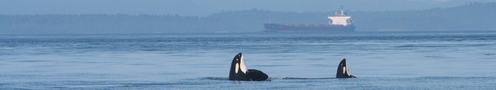
Here is an excerpt from yesterday’s WDFW announcement that describes the forecasts for many Columbia and Salish Sea salmon runs.  To Pat’s credit, there was a quick correction to a painful error (suggesting that adipose-clipped fish weren’t hatchery fish).  In conjunction with the process-map in the previous post, these dates should help us orca-advocates be in the right place at the right time to “speak for the whale’s” share of NW salmon…  Better speak now before they start shooting orcas like the CA sea lions lounging at the Bonneville debacle…

Preseason salmon forecasts developed by the Washington Department of Fish and Wildlife (WDFW) and treaty Indian tribes, were released today at a public meeting in Olympia.

Forecasts for chinook, coho, sockeye, pink and chum salmon mark the starting point for developing 2009 salmon-fishing seasons in Puget Sound, the Columbia River and Washington coastal areas. Fishery managers have scheduled a series of public meetings through March before finalizing fishing seasons in early April.

While several salmon runs are up this year, fishery managers still face a number of challenges in crafting fisheries that meet conservation goals for weak salmon stocks, said Phil Anderson, WDFW’s interim director.

“Conservation of wild fish will continue to be our top priority,” Anderson said. “We will work hard with tribal co-managers and our constituents to create fishing opportunities for hatchery fish while ensuring that we are successful in meeting conservation objectives for wild fish populations.”

One constraining stock this year is the Bonneville Pool hatchery fall chinook run, a major contributor to Washington’s coastal fisheries. Although the overall return of Columbia River fall chinook is forecasted to be higher than last year, catch quotas for chinook in the river and the ocean will likely be low because of the poor Bonneville Pool return and restrictions needed to protect wild salmon listed under the federal Endangered Species Act (ESA).

While salmon forecasts are up overall in the Columbia River, coho and chinook returns to Puget Sound are expected to be slightly down this year.

A few individual Puget Sound coho stocks, including the Skagit and Stillaguamish, are expected to return at low levels and will require additional protective measures this summer, said Pat Pattillo, salmon policy coordinator for WDFW. The overall summer/fall chinook forecast for Puget Sound, where wild chinook salmon are listed for protection under the federal ESA, is 222,000 fish, a slight decrease from last year’s forecast.

“It’s important that we continue working to recover and protect wild salmon populations in Puget Sound,” Pattillo said. “One management tool we can use that helps with those recovery efforts and allows us to provide meaningful recreational fishing opportunities is mark-selective fisheries.”

In the last two years, WDFW has added several recreational mark-selective fisheries for hatchery chinook in Puget Sound. These fisheries allow anglers to catch and keep abundant hatchery salmon – marked with a missing adipose fin – but require that they release wild salmon.

Pattillo said consideration of additional mark-selective fisheries for hatchery chinook in Puget Sound, as well as in the ocean, will be on the agenda during this year’s North of Falcon meetings.

A bright spot for Puget Sound this year is the pink salmon run. More than 5.1 million pink salmon are expected back to Puget Sound streams this summer, nearly 2 million more fish than forecasted in 2007. The smallest of the Pacific salmon species, the majority of pink salmon return to Washington’s waters only in odd-numbered years.

Another strong fall chum salmon return also is forecasted for Hood Canal and other areas of Puget Sound, where the run is expected to total nearly 915,000 fish. But a Lake Washington sockeye fishery is unlikely this year. The sockeye forecast is about 20,000, well below the minimum return of 350,000 sockeye needed to consider opening a recreational fishery in the lake.

Meanwhile, coho returns to several coastal rivers, including the Hoh and Quillayute, are expected to be up this year, Pattillo said.

State, tribal and federal fishery managers will meet March 8-13 in SeaTac with the Pacific Fishery Management Council (PFMC) to develop options for this year’s commercial and recreational ocean chinook and coho salmon fisheries. The PFMC establishes fishing seasons in ocean waters off the Pacific Coast.

Seven additional public meetings have been scheduled in March to discuss regional fisheries issues. Input from these regional discussions will be considered as the season-setting process moves into the “North of Falcon” and PFMC meetings, which will determine the final 2009 salmon seasons. The meetings are set for:

* March 4 – Grays Harbor fisheries discussion, 6 p.m.-8 p.m., Montesano City Hall, 112 N. Main St., Montesano.
* March 5 – Willapa Bay fisheries discussion, 6 p.m.-8 p.m., Raymond Elks Lodge, 326 Third St., Raymond.
* March 11 – Puget Sound commercial fisheries discussion, 10 a.m.-noon, WDFW Mill Creek Office, 16018 Mill Creek Blvd., Mill Creek.
* March 11 – Puget Sound recreational fisheries discussion, 6 p.m.-8 p.m., WDFW Mill Creek Office, 16018 Mill Creek Blvd., Mill Creek.
* March 16 – Columbia River fisheries discussion, 9 a.m.-3 p.m., Vancouver Water Resources Education Center, 4600 S.E. Columbia Way, Vancouver, Wash.
* March 19 – Final Grays Harbor and Willapa Bay fisheries meeting, 9 a.m.-5 p.m., Room 172 of the Natural Resources Building, 1111 Washington St. S.E., Olympia.
* March 19 – North of Falcon salmon fisheries discussion, 6 p.m.-9 p.m. Benton PUD, 2721 W. 10th Ave., Kennewick.

Two public North of Falcon meetings, which involve planning fishing seasons for Washington’s waters, including Puget Sound, also will take place in March. The first meeting is scheduled March 17 at the Lacey Community Center, and the second meeting is scheduled March 31 at the Lynwood Embassy Suites. Both meetings will begin at 9 a.m.

The PFMC is expected to adopt the final ocean fishing seasons and harvest levels at its April 4-9 meeting in Millbrae, Calif. The 2009 salmon fisheries package for Washington’s inside waters will be completed by the state and tribal co-managers during the PFMC’s April meeting.

Preseason salmon forecasts, proposed fishing options and details on upcoming meetings will be posted as they become available on WDFW’s North of Falcon website at http://wdfw.wa.gov/fish/northfalcon/ .

A map for including killer whales in NW fisheries managment

Just happened upon this nice synopsis of how WDFW views the various processes by which fishing harvests are governed in the Pacific Northwest. For me, this helps clarify which processes we killer whale advocates could influence to bolster the number of salmon and other fish that are available to feed the southern residents. As usual, the words “orca” or “whale” isn’t present in this document, though the may soon be included next to the reference to the ESA…
clipped from wdfw.wa.gov
Washington Department of Fish and Wildlife

How salmon fishing seasons are set
Harvest rules built on foundation of
scientific surveys, computer models, joint deliberations
Managing Washington’s fisheries – in particular salmon – is acknowledged as one of the most complex natural resource challenges in the country, due to the interplay of biological and geographical factors.
The annual process of setting scientifically sound fishing seasons begins each year with a pre-season forecast of the abundance of various individual fish stocks.
After the biological information and data gleaned from coded wire tags is agreed to by the co-managers, they are assembled into a computer model that offers a snapshot of an upcoming season’s fishery under various regulation options. The results from these computer simulations are then compared to conservation goals, obligations under U.S.- Canada treaties, allocations for tribes and protection requirements for some wild fish population under the Endangered Species Act.
  blog it

Loss of salmon smolts in BC and CA

An awareness seems to be dawning that salmon smolt mortality is increased by human activities — both in the nearshore environment and in river systems. A recent biological opinion regarding Sacramento salmon suggested that about 8% of the smolts entering the San Juaquin / Sacramento delta make it through to the ocean. This article mentions an early warning that the Chinook smolts that do make it to the ocean have been doing less and less well in Georgia Basin over the last 12 years. That doesn’t bode well for our southern residents who appear focus on returning Fraser Chinook for 80-90% of their summer diet…
clipped from seattlepi.nwsource.com
SEATTLEPI.COM
Coho, chinook in ‘dramatic’ decline

But pink salmon survival rising in B.C.

By ROBERT McCLURE
P-I REPORTER

Coho and chinook are in decline — but curiously, pink salmon survival appears to be increasing, Richard Beamish of the Canadian Department of Fisheries and Oceans told participants in the biennial Puget Sound/Georgia Basin Ecosystem Conference.

Scientists have long known that only a small percentage of the juvenile salmon that leave freshwater rivers to live in the sea return to spawn at the end of their lives. But the new research shows that percentage has drastically decreased since 1980. In coho, it dropped from 10 percent to 0.5 percent, Beamish said. In chinook, it decreased from 1 percent to 0.1 percent.

Beamish’s research shows that over the past 12 years, the survival of coho in Georgia Strait in their first four months dropped dramatically. About 15 percent of the fish disappear in those first four months, Beamish said.
  blog it

Strong spring chinook run on the Columbia

Here we are in mid-February, a couple weeks into the blackmouth opening in the Salish Sea, and WDFW is opening up recreational fishing for spring (winter?) Chinook running in the Columbia [see today’s email announcement below].  This makes me wonder where the southern residents are at the moment and what the run timing looks like for California Rivers, coastal OR rivers, and the Fraser.  Why in the world isn’t a simple Gantt diagram for this famous phenomena!?

This is the first time I’ve gotten a sense of when the spring run gets going and it’s earlier than I expected.  Yesterday Sam Wasser showed us some plots that suggest that southern residents are about as well fed as they are all summer when they first show up in ~June.  That got me wondering whether Fred Felleman is right — that their main source of annual sustenance is the really big, oily spring Chinook destined for the highest parts of the biggest river systems (and fisher’s dinner tables, now).

WDFW NEWS RELEASE

February 12, 2009
Contact:  WDFW Region 5 Office, (360) 906-6708

Columbia River spring chinook season reflects projection of strong runs

OLYMPIA – Anglers will be able to fish for spring chinook salmon from the mouth of the Columbia River to Bonneville Dam through mid-April under initial seasons adopted Wednesday, Feb. 11, by fishery managers from Washington and Oregon.  Anticipating a strong run of spring chinook to the upper Columbia River and improved returns to the Willamette, the two states agreed to provide significantly more days of fishing – particularly below Hayden Island – than last year.

According to the pre-season forecast, nearly 300,000 upriver spring chinook are expected to enter the Columbia River this year, which would make this year’s return the third highest since 1977.  An additional 37,000 “springers” are also expected to return to the Willamette River, up from 27,000 last year.

“This is shaping up to be a very good year for spring chinook fishing in the Columbia River,” said Cindy LeFleur, Columbia River policy coordinator for the Washington Department of Fish and Wildlife (WDFW).  “The first fish have just begun to arrive, and we hope to see a lot more of them in the months ahead.”

Below Hayden Island, the new season provides 30 days of spring chinook fishing in March and April, compared to just 12 days last year.  During those two months, anglers also will have 39 days – up from 36 days last year – to catch and retain spring chinook from Hayden Island upriver to Bonneville Dam.

LeFleur noted that the fishery could extend beyond April, but that late-season regulations have not been set because of differences between the fish and wildlife commissions of Washington and Oregon over how to allocate the catch.

In March and April, Columbia River anglers will be able to fish for spring chinook salmon at the following locations and times:

* West power lines on Hayden Island downstream to Buoy 10:   Seven days per week from March 1-15.  Beginning March 16 through April 18, fishing will be limited to three days per week, Thursdays through Saturdays.
* West power lines on Hayden Island to Bonneville Dam:   Seven days per week from March 1-22.  Beginning March 23 through April 22, fishing will be limited to four days per week, Wednesday through Saturday.
* Tower Island power lines above Bonneville Dam to McNary Dam:   Seven days per week from March 16 through April 30.  The Washington and Oregon bank fishery will also be open from Bonneville Dam upstream to the Tower Island power lines.

Until March 1, the spring chinook fishing is open under regulations described in the 2008-09 Fishing in Washington rule pamphlet (good until April 30, 2009).  Anglers fishing for spring chinook salmon may also retain shad and hatchery steelhead, as outlined in the rule pamphlet.

In all areas, anglers are required to release any chinook salmon not clearly marked as a hatchery-reared fish, since a portion of the wild upriver spring chinook run is protected under the federal Endangered Species Act.  Unmarked steelhead must also be released.  Hatchery fish can be identified by a clipped adipose fin with a healed scar.

Under a new rule approved by the Washington commission, anglers fishing below McNary Dam may retain two hatchery-reared adult salmon or steelhead (or one of each) per day.  However, only one adult chinook salmon may be retained per day downstream from Bonneville Dam.

LeFleur noted that standing rules limit incidental mortality of wild spring chinook intercepted and released in all state fisheries – recreational and commercial – to 2.2 percent of the total run.   “It’s essential that anglers observe the rules requiring the release of wild salmon and steelhead,” LeFleur said.  “Our ability to continue these fisheries depends on it.”

Oil Spill Risk Management: Strategies for the future

Intro by Miles (Chip) Boothe

Over 600 vessels have been escorted by the Neah Bay tug since it first started operating in 1999; 6 involved throwing lines to a vessel in distress.  This afternoon the legislature is looking at a new measure to fund the tug permanently (beyond the 1 year that Governor Gregoire recently promised) and transfer the burden of cost to the maritime shipping industry.

See Fred Felleman’s guest column in the Seattle Pi (Feb 4, 2009) [~40% of tankers calling on WA are single-hulled; WA has 5 refiners that process 9 billion gallons crude/yr;

Dan Doty: Slick Fixes for the Salish Sea – Restoring Natural Resources after Oil Spills

Prevention is important, but what happens if a spill occurs?  Three types of responses:

  • Restoration is handled by Natural Resouce Damage Assessment (NRDA; guided by State and Federal law).
  • Oil spill response (incident command system)
  • investigations

Most spills are small.  NRDA is WA compensation schedule ($1-100/Gal damages go into a fund that is used for restoration)

Bigger spills involve planning and preparation:

  • NRDA guidance and team organization, early assessment plans (EDCPs), training, science, monitoring
  • Initial chaos, logistical issues, though there is a pre-organized oil spill response system
  • Recommendations for conducting cooperative natural resource damage assessment (April 07 West Coast Joint Assessment Team)
  • Collection of data through ephemeral data collection plans and sampling “go kits” and caches (e.g. with Makah Tribe, Navy)
  • Key issue is staffing, training, drilling: field crews need Hazwoper Training, scientifically and legally defensible (chain of custody) data must be collected through specialized resource teams.  We’re incorporating a worst case drill into training of NRDA team.
  • One of the first tasks is to identify key resources at risk, focus injury assessments on highest priorities, look for baseline data to assess impacts.  So, baseline data is being collected and maintained (e.g. at Padilla Bay GIS).
  • Oil spills have sub-lethal and long-term effects on aquatic ecosystems (e.g. PAHs affect herring eggs)

Restoration is the goal of this whole process.  We need to invest in preparation to do a good job when a spill happens.

Evaluating Capacity to Respond to Large-scale Oil Spills in Puget Sound and the Georgia Basin, Jacqui Brown-Miller

Later this week the Washington Oil Spill Advisory Council will publish “Assessment of capacity in WA State to respond to large-scale marine oil spills.”  This is a synopsis of the assessment of what to do in the first 48 hours after a ~50k barrel spill.  The results of the study will likely guide upcoming policy revisions.

Response modes:

  1. recover oil with skimmers
  2. sensitive shoreline protection with booms
  3. in-situ burning and chemical dispersent
  4. shoreline clean-up in urgent phase (to keep that oil from moving further)
  5. wildlife response (usually doesn’t start until after 48 hours)

Results:

  • WA state has existing resources to recover only 9500-19500 barrels of a 50k barrel instantaneous release.
  • Numeric estimations accounted for senarios with various spill behavior, response tactics, swath width, recovery system efficiency and storage capacity.
  • Response capacity is highest near equipment caches; Port Angeles is highest; lowest are on outer coast.
  • It looks like ~32k feet of boom is stored in Mackaye Bay (or somewhere near Lopez Island)
  • 1400-1800 barrels may be dispersed; ~4k could be burned; we have optimistically 684 response personel; manual removal off beach would require 100s to 1000s of workers; mechanical removal should have an advance policy about when/where such “scraping off” could occur
  • Working on a hazing plan to keep marine mammals away.
  • Wave and wind limitations mean that mechanical recovery would be unimpaired 94% of the time in inland waters, but only ~25% of the time on outer coast.
  • Main uncertainties: availabililty of people and equipment (day of week, can multiple gear be deployed simultaneously?)
  • We need more on-water storage devices and earth-moving equipment and cleanup equipment (e.g. super-sacks).

Looking to the Future – Training, Drills, and Exercises, David Sawicki

Dept of Ecology has a  Spill Drill checklist that is aligned with the Northwest Area Contingency Plan and designed to test the functionality of the Incident Command System.  Federally, there is National Preparedness for Response Plan document.

The present state: Incident Command System is probably best in the world

Future state: Increased focus on field activities (not incident command post where we are excellent)

  • shoreline cleanup
  • wildlife rescue/rehabilitation
  • dispersant approval / application process
  • volunteer management
  • staging area management
  • decontamination

We need to do this through workshops and coordinated training (leveraging proximal refineries and response organizations).  We need to move past repetitive checklist 3-year cycle approach.   “Many of us are ready for graduate school.”  We also need to develop more realistic goals (only a mag 9 earthquake would cause some of the scenarios we train for…)

Panel discussion

Kathy Fletcher: Prevention is the most important thing we can do.  Right now we have a 5cent/barrel tax that funds our prevention and response activities, but the revenue is unpredictable because if oil is shipped out of WA the tax is refunded.  The Oil Spill Advisory Council needs to advise the legislature on ways to stabilize the revenue (though the Governor has suggested abolishing the Council itself).   This March 24th will mark the 20th anniversary of the Exxon spill where lack of vigilance was the main reason the damage was so grave.

Richard Wright: Runs largest private, non-profit Marine Spill Response Company (4M barrel clean-up capacity, nationally??).  WA State is very well prepared and we have an MOA with Burrard, a Canadian counterpart.  A single phone call will access their full resources.

Linda Pilkey-Jarvis: possible big spills are from 10k barrels to ~3M barrels.  We have gained rules in latest regulatory framework that make review of plans optimal, e.g. standards for skimmer efficiency equipment.  We’ve pushed equipment caches to outer coast areas and San Juan Islands.  Some companies are close to compliance, but many have a ways to go as we begin this 3 year process.  Before plans are approved, we go into field to verify procedures and resources.

Contaminant deposition in NW National Parks

Dixon Landers

2002-2008 WACAP study ocused on high-elevation and remote systems with lakes as precipitation collectors.  We weren’t supposed to inform fluxes to Puget Sound, but we may have discovered that the snow that melts into our inland sea starts out contaminated!  Data sources are snow samples, sediment cores, fish samples, lichen, and water.  We looked at broad suite of volatile organic compounds, metals, and nitrogen from the Arctic to Texas.  In WA we sampled Olympic, Rainier, and N Cascades Parks (vegetation and snow only).

Results:

  • Mean whole body fish [DDT]sum = 1-4ng/g, pretty uniform across PS parks (implying global, not local sources), but well below toxicity thresholds.  [Hg] are among highest of all Western Parks; sediment cores show increase in Hg in recent years, probably due to global sources.

Atmospheric deposition of POPS to Georgia Basin

Marie Noel

PCBs are transported through the atmosphere in both gas and particulate phases.  In Great Lakes and Baltic Sea, the majority of aquatic PCBs come from atmospheric transport.  Transport from Asia to BC takes 2-10 days.  One sampling site at Ucluelet as reference for Saturna Island samples (gas (86% of PCBs, 63% PBDEs), particulate (porportionally more heavy congeners), and rain phases).  PCB heavy congeners dominated by tri and tetra; PBDEs by tetra, penta and deca.

PBDE deposition was higher than PCBs overall.   PCBs about same between sites, suggesting global sources.  ~50% of PBDEs are coming from local sources, and the increase above reference is mostly due to heavier PBDEs (tetra, penta, deca).  The point of origin is 20% from Asia; no north American sources can account for the coastal deposition in BC.

2004 deposition mass: 3.5 kg PCB, 20 kg PBDE (BDE 209 makes of 56%)

Duwamish contaminant in suspended sediments

Thomas Gries

We collected samples upstream of the southern boundary of the lower Duwamish clean up area and then compared with samples taken further downstream.   Background: focus on Harbor Island and a cleanup site at river mile 4.8, site selection and future load inluenced by sediment transport model and analysis report:

  • >95% sediment load from upstream
  • 50% fine suspended sediment passes through site

Upstream sampling at 6/1oth max depth was chosen to avoid upstream transport by salt wedge, but downstream of most point-sources.  Looked at 63 and 250 micon sediment size fractions. We saw high [PCB, dioxins, arsenic] in August, low in November and December.  Suspended sediment PCB loading may be lower than predicted.  Peak loading is associated with storm events.

PCB bioaccumulation model for Puget Sound

Jeff Stern

Mapping C flow through the food web can help us understand trophic strucure and species interactions and ass feeding guilds and which species may be most at risk from bioaccumulation.  Our model is a steady state partitioning (Arnot and Gobas, 2004; Condon, 2007) that uses Tim Essingtons trophic structure data, diet data from John Ruem (2006 UW thesis), and other parameters from many others.  Essington’s data show that biomass and diet change dramatically with depth strata.

Our simplified model for the central basin of Puget Sound yields 9 out of 10 estimates for species or feeding guilds that are within factor of 2 of field measurements.  We have almost no data for plankton and spiny dog fish in the central basin.

Results:

  • For every unit you reduce water concentrations of PCBs, you get a 0.7 unit reduction in tissues; this is a linear response for all species; for 50% reduction in loading you get about 55 picograms/l in tissues.
  • The ratio for sediment conentrations of PCBs is 0.3; taking out all PS hot spots will reduce tissue concentrations by only about 15%.
  • These ratios vary by species (benthic, pelagic); eg English sole is most affected by sediment concentrations.  (Scott thot: SRKWs are known to eat Dover Sole in non-summer seasons…)
  • Even in most optimistic scenario, tissue reductions are only likely to be 15-25%.

Simplified food web structure seems to do well in approximating carbon flows, so we believe we are accurately modeling transfer of PCBs, generally.  You can add complexity to understand specific species’ situations.  We also believe you’ll need different simplified model for each basin in the Salish Sea.  That means we’ll need data from each basin!  And it means that we’ll need more complicated (trans-basin) models for species with complex foraging behaviors, like killer whales.